
Choosing a college major can feel like trying to read a map without knowing your destination. If you enjoy math, technology, outdoor work, and solving practical problems, a surveying major may point you toward a career that is both specialized and in demand. Surveyors establish the boundaries, elevations, and locations that make construction, transportation, land development, and property ownership possible.
A surveying degree is more hands-on than many students expect. You may spend part of your week learning geometry, law, and geographic information systems (GIS) in class, then apply those concepts outside with a total station, GPS receiver, or drone. The field also offers a clear professional pathway through internships, supervised experience, certification, and, depending on your responsibilities and state, the Professional Land Surveyor (PLS) license.
This surveying college major review examines what you'll study, how much fieldwork to expect, likely career paths, salary considerations, and how surveying compares with related majors. The goal isn't to sell you on the degree. It's to help you decide whether its mix of precision, responsibility, technology, and outdoor work fits your interests and long-term plans.
Surveying Major At A Glance: Coursework, Skills, And Degree Options
A surveying major prepares you to measure and document land, property, structures, and physical features. Depending on the school, the program may be called land surveying, geomatics, surveying engineering technology, or surveying and mapping. Some colleges offer a dedicated bachelor's degree: others place surveying within civil engineering technology or geomatics.
You'll typically develop skills in:
- Trigonometry, geometry, calculus, and applied statistics
- Boundary research, property law, and legal descriptions
- Surveying instruments and field procedures
- Computer-aided design (CAD) and digital mapping
- GIS, remote sensing, photogrammetry, and GPS
- Construction layout and site measurement
- Technical writing, project documentation, and communication
Degree options vary in length and professional focus:
| Program | Typical length | Best fit |
|---|---|---|
| Certificate | Less than 2 years | Entry-level field or technician skills |
| Associate degree | About 2 years | Surveying technician and assistant roles |
| Bachelor's degree | About 4 years | Broader career options and licensure preparation |
| Graduate study | 1–3 additional years | Research, advanced geomatics, or management |
An associate degree can get you into the industry quickly, while a bachelor's degree generally gives you more flexibility if you eventually want licensure or supervisory responsibility. Check your state board and the school's accreditation before enrolling, because education requirements for licensure differ across the United States.
What Do Surveying Students Learn In College?
Your classes will combine mathematical theory with procedures you can use on an actual job site. Early coursework often covers college algebra, trigonometry, physics, technical drawing, and introductory surveying. You'll learn how angles, distances, coordinates, and elevations relate, and how small measurement errors can affect an entire project.
As you progress, courses may include:
Boundary and Legal Surveying
You'll research deeds, easements, plats, public records, and historical survey evidence. This is where surveying becomes more than "measuring land." Your work may help determine where one property ends and another begins, so you'll need to interpret legal language carefully and explain your conclusions clearly.
Construction and Engineering Surveying
Construction surveying focuses on transferring plans onto the ground. You might locate building corners, establish grades, check foundations, or set points for roads and utilities. Accuracy and timing matter because mistakes can cause expensive delays.
GIS, CAD, and Geomatics
Modern programs increasingly teach GIS software, CAD drafting, digital data collection, databases, and spatial analysis. You may also study remote sensing, laser scanning, unmanned aircraft systems, and photogrammetry. These tools allow professionals to collect and visualize large amounts of location data.
Professional Practice
Expect classes in surveying ethics, project management, contracts, business practices, and state-specific regulations. You'll also practice writing reports and presenting technical information. A strong surveyor must be able to explain complicated evidence to property owners, engineers, contractors, attorneys, and government officials, not just produce accurate coordinates.
Why Major In Surveying? Benefits, Challenges, And Personal Fit
The answer to Why Major in Surveying depends on what you want from college and work. Surveying can be a strong choice if you prefer applied learning and want a career where your work produces visible results. You may help define a property line, support a bridge project, map a floodplain, or prepare data for a new neighborhood.
Potential benefits
- A practical career path: Your skills connect directly to construction, infrastructure, real estate, and public works.
- A blend of indoor and outdoor work: You're unlikely to spend every day behind a desk, or outside in every season.
- Technology and variety: Instruments and software continue to evolve, giving you opportunities to specialize.
- Professional responsibility: With experience and licensure, you can take on projects and potentially operate your own firm.
- Transferable technical skills: CAD, GIS, data analysis, and project coordination are useful beyond traditional surveying.
The challenges are real. Fieldwork can involve early mornings, travel, heat, cold, mud, traffic, and uneven terrain. You'll need patience because measurements, notes, and calculations must be checked carefully. Boundary disputes can also be stressful: clients may want a particular answer, but your responsibility is to follow evidence and professional standards.
Surveying may not suit you if you strongly dislike outdoor conditions, repetitive verification, legal research, or detailed math. Before committing, ask local firms about job shadowing or part-time work. A few hours beside a survey crew can tell you more than a glossy program brochure.
Surveying Technology, Fieldwork, And Classroom Experience
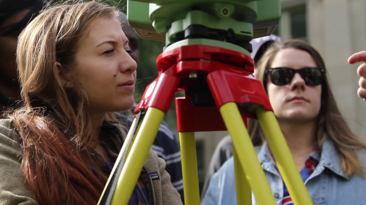
Surveying education is typically active. Instead of learning every concept only through lectures, you'll practice setting up equipment, collecting observations, calculating positions, and preparing deliverables. Group field exercises are common because real survey work requires communication: one person may operate the instrument while another manages the prism, stakes points, records notes, or checks procedures.
Common technology includes:
- Total stations: Electronic instruments that measure angles and distances for precise positioning.
- GNSS/GPS receivers: Satellite-based equipment used for positioning and mapping.
- Digital and robotic instruments: Tools that improve efficiency and allow one-person operation in some situations.
- Laser scanners: Systems that capture dense three-dimensional point clouds.
- Drones: Aircraft used for aerial imagery, mapping, and photogrammetry where regulations and project requirements permit.
- CAD and GIS platforms: Software for drafting, analyzing, managing, and presenting spatial information.
Your classroom experience may include labs, field notebooks, surveying camps, design projects, and software assignments. Accuracy is usually graded alongside process. A final map can look polished, but if your control points, metadata, or field notes are weak, the result may not be acceptable.
You'll also learn that technology doesn't eliminate judgment. GPS signals can be obstructed, a deed can conflict with physical evidence, and a drone image can't automatically answer a boundary question. The best programs teach you when to trust an instrument, when to investigate further, and when to ask a licensed professional for guidance.
Career Preparation: Licensure, Internships, And Professional Skills
If you want to become a licensed land surveyor, investigate the pathway before choosing a program. Requirements vary by state, but the process commonly combines approved education, examinations, supervised experience, and a record of responsible work. The National Council of Examiners for Engineering and Surveying provides examination information, while your state licensing board controls the rules that apply where you plan to work.
Many students encounter the Fundamentals of Surveying (FS) exam early in their careers. With education and experience, they may pursue the Principles and Practice of Surveying (PS) exam and state-specific requirements. Licensure can be especially important when you want to certify boundary surveys, sign legal documents, or offer services directly to the public.
An internship is one of the most valuable parts of your preparation. Look for placements with:
- Land surveying firms
- Civil engineering companies
- Construction contractors
- County, city, or state transportation departments
- Utility and environmental organizations
- Mapping, GIS, or geospatial technology companies
When comparing colleges, ask whether the program has employer partnerships, field equipment, career placement data, and faculty with current industry experience. You should also build professional habits: clear field notes, careful file management, ethical decision-making, teamwork, and concise client communication. Employers can teach software, but reliability and willingness to verify your work are harder to teach.
Professional organizations such as the National Society of Professional Surveyors and state surveying associations may provide networking, scholarships, conferences, and mentoring. These connections can help you understand local licensing expectations and find your first position.
Job Opportunities For Surveying Majors In The United States
The Job Opportunities for Surveying Majors extend beyond the traditional image of a crew measuring roadsides. Your options may include:
| Career path | Typical responsibilities |
|---|---|
| Surveying technician | Collect field measurements, maintain equipment, and assist with documentation |
| Survey crew member | Perform field observations, set points, and communicate site conditions |
| CAD technician | Prepare plans, plats, construction drawings, and digital deliverables |
| Boundary surveyor | Research property records and determine or document boundaries |
| Construction surveyor | Lay out buildings, roads, utilities, grades, and structural elements |
| GIS or mapping specialist | Manage spatial databases, maps, imagery, and location analysis |
| Photogrammetry or remote-sensing technician | Process aerial imagery, scans, and three-dimensional data |
| Project surveyor or PLS | Review work, manage projects, and assume licensed responsibility |
Demand is connected to construction, transportation upgrades, renewable energy, housing development, environmental management, and public infrastructure. The U.S. Bureau of Labor Statistics Occupational Outlook Handbook tracks surveyor employment, pay, and projected trends, while surveying and mapping technicians are listed separately.
Your first role may involve substantial field assistance, but career progression can be steady if you keep learning. Experience with boundary research, construction layout, GIS, 3D scanning, or machine control can make you more competitive. Geographic flexibility may help, too: fast-growing regions and states with significant infrastructure or land-development activity often provide more openings.
Job titles and duties differ by employer. Read postings carefully, especially if a position is labeled "surveyor" but actually focuses on entry-level data collection or CAD production.
Expected Starting Salary In The US For Surveying Majors
The Expected starting Salary in the US for Surveying Majors depends on your degree, location, experience, licensing status, and the kind of work you perform. An associate graduate entering as a surveying technician may start at a different level than a bachelor's graduate joining a construction or engineering firm. Overtime, travel allowances, public-sector benefits, and seasonal workload can also affect total compensation.
For current figures, use the BLS wage data for surveyors and surveying and mapping technicians, then compare them with local job postings. National medians are useful for context, but they are not promises about your first paycheck. Entry-level offers in high-cost metropolitan areas may look larger while leaving you with less purchasing power than a moderate offer in a smaller community.
Your salary outlook can improve when you:
- Complete an internship before graduation
- Develop strong CAD, GIS, and data-processing skills
- Learn construction layout or specialized scanning technology
- Pass relevant exams and document qualifying experience
- Build a portfolio of maps, plans, or class projects
- Become comfortable communicating with clients and contractors
Ask employers whether the role includes paid overtime, exam support, health insurance, retirement benefits, travel reimbursement, and scheduled raises. A slightly lower starting salary may be worthwhile if the job offers structured mentoring and qualifying experience for licensure. Conversely, a higher wage with little training may slow your long-term progression.
Because compensation changes by year and region, treat salary websites as research tools rather than guarantees. Your college's recent graduate outcomes and nearby employer interviews will usually provide the most relevant estimate.
Surveying Compared With Civil Engineering, Geography, And Construction Management
Surveying overlaps with several majors, but the day-to-day work and educational emphasis are different. Comparing them can help you avoid choosing a degree based only on a familiar job title.
| Major | Primary focus | Typical work style | Choose it if you prefer… |
|---|---|---|---|
| Surveying/geomatics | Measuring, mapping, boundaries, and spatial data | Fieldwork plus technical office work | Precision, land, instruments, and applied math |
| Civil engineering | Designing and analyzing infrastructure | Engineering design, analysis, and project work | Calculus, physics, structures, and system design |
| Geography/GIS | Understanding places, patterns, and spatial relationships | Research, mapping, analysis, and planning | Data interpretation, society, environment, or maps |
| Construction management | Coordinating construction projects | Scheduling, budgets, crews, and site operations | Leadership, logistics, and building processes |
Civil engineering generally requires more advanced engineering analysis and can lead to design responsibilities for structures, transportation systems, water resources, and other infrastructure. Surveying is more focused on accurately locating and documenting the physical world, although surveyors and civil engineers work closely together.
Geography may offer broader subject choices, especially in environmental, urban, cultural, or GIS work. It may require you to pursue internships or technical specialization to reach a specific entry-level occupation. Construction management is a better match if you're energized by schedules, subcontractors, budgets, and daily site coordination rather than measurement and boundary evidence.
There's no universal "better" major. Think about the tasks you'd willingly practice for several years. If you like turning a messy physical site into dependable coordinates and drawings, surveying may fit you better than a broader major.
Pros And Cons Of Choosing A Surveying Major
A quick review of the major's advantages and drawbacks can make your decision more concrete.
Pros
- Direct connection to employment: Your coursework develops skills employers can recognize and use.
- Varied work settings: You may divide your time among offices, construction sites, rural properties, public projects, and client meetings.
- Technology-rich work: Surveying offers exposure to GNSS, scanning, drones, CAD, GIS, and automation.
- A defined advancement route: Experience, exams, and licensure can lead to greater responsibility.
- Visible public impact: Your work supports safe construction, accurate ownership records, infrastructure, and land planning.
- Potential for independence: Experienced licensed surveyors may manage projects or establish firms.
Cons
- Weather and physical demands: Fieldwork can mean walking, lifting equipment, and working in uncomfortable conditions.
- Precision pressure: Errors can create financial, legal, or safety consequences.
- Licensure complexity: Requirements vary by state and may take several years to complete.
- Uneven work environments: Some jobs require travel, long drives, or changing schedules.
- Routine early-career tasks: Entry-level work may include equipment transport, clearing lines, data entry, or repetitive checks.
- Technology learning curve: Software and instruments change, so continuing education is part of the job.
The biggest question is not whether surveying has drawbacks, it does, but whether those drawbacks are acceptable in exchange for the work you want. Talk to at least one field technician and one licensed surveyor. Their experiences may differ significantly, and both perspectives matter.
Surveying College Major: Frequently Asked Questions
What skills and subjects will I learn in a surveying college major?
You'll study math like trigonometry and calculus, property law, surveying instruments, GIS, CAD, remote sensing, and professional practices such as technical writing and project management.
How much fieldwork is involved in a surveying degree program?
Surveying education is hands-on, combining classroom learning with regular outdoor activities using total stations, GPS, drones, and other equipment to apply concepts in real-world settings.
What career opportunities are available for surveying majors?
Graduates can become surveying technicians, boundary surveyors, construction surveyors, GIS specialists, or licensed Professional Land Surveyors with roles in construction, land development, and public infrastructure.
How does surveying compare to related majors like civil engineering or geography?
Surveying focuses on precise measurement and mapping of land and boundaries, combining field and technical work, whereas civil engineering emphasizes infrastructure design, and geography emphasizes spatial analysis and environmental applications.
What are the benefits of becoming a licensed Professional Land Surveyor (PLS)?
Licensure enables you to certify surveys, assume legal responsibility, manage projects, and increase career advancement, often allowing you to operate your own surveying firm with greater professional autonomy.
What are the challenges of a surveying major and career?
Challenges include outdoor fieldwork in varying weather and terrain, the need for precision to avoid costly errors, legal research demands, repetitive verification tasks, and staying current with evolving technology.